
InfoSAWIT, JAKARTA – Practical training is becoming increasingly important in strengthening the ability of Indonesian palm oil smallholders to map and manage their plantation areas, particularly as accurate spatial data becomes more relevant to plantation planning, monitoring, and administration.
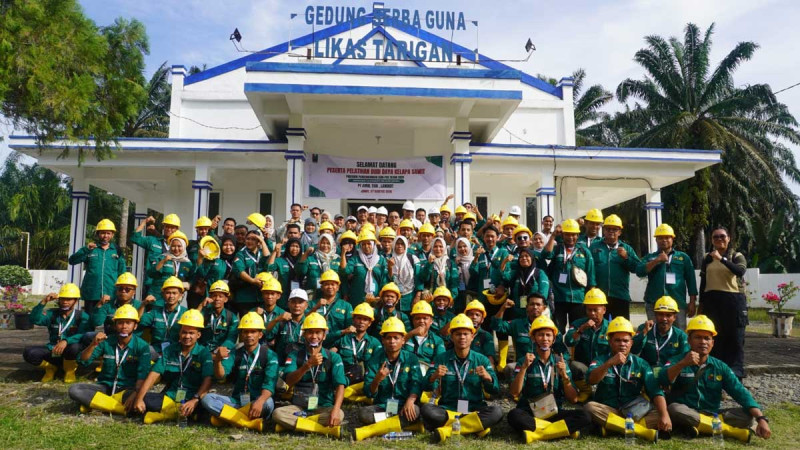
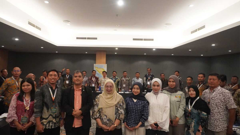
This approach was reflected in a field trip attended by 28 participants of the first Technical Training on Palm Oil Plantation Location Mapping at Gapoktan Tani Mandiri in Batu Bara Regency, North Sumatra. The activity formed part of the 2026 Palm Oil Plantation Human Resources Development Program.
The participants, who came from Aceh Singkil Regency, Aceh Province, used the field session to test and apply knowledge gained during the training. They were introduced directly to plantation conditions and the various stages involved in producing plantation maps.
The practical exercise covered several key activities, including identifying plantation boundaries, determining geographic coordinates, observing land conditions, and collecting field data.
Participants were also introduced to the use of drones to capture aerial imagery. The resulting photographs can serve as an additional source of updated imagery for plantation mapping and spatial analysis.
Mapping Goes Beyond Measuring Plantation Areas
The field training demonstrated that plantation mapping is not simply about determining the location or size of a plantation.
Accurate spatial data can support plantation inventories, development planning, monitoring, supervision, and more informed decision-making. Information on boundaries, coordinates, land characteristics, and plantation conditions can provide a clearer picture of the actual situation on the ground.
Director of PT Koompasia Enviro Institute Henry Marpaung said field practice was essential because participants needed to experience each stage of the mapping process directly.
“Mapping cannot be understood through theory alone. Participants need to see and practice each stage directly, from identifying plantation conditions and determining boundaries and locations to collecting data,” Henry said in a statement received by InfoSAWIT on Thursday (August 13, 2026).
He said the field experience was expected to strengthen participants’ readiness to apply their mapping skills after returning to their respective regions.
The Agriculture and Plantation Agency of Aceh also welcomed the practical component. Mukhlis said field trips provided participants with a more concrete learning experience than classroom-based instruction alone.
“Field trips like this are very important because participants not only receive theoretical knowledge, but can also directly observe and practice the mapping process in the field,” Mukhlis said.
Smallholders Gain a Better Understanding of Spatial Data
The practical activity also provided an opportunity for the host farmer group to learn more about the role of spatial information in plantation management.
Chairman of Gapoktan Tani Mandiri, Ruslan Sinaga, welcomed the use of farmers’ land as a field training location. He said the activity benefited both the trainees and local farmers by demonstrating how mapping can provide a clearer picture of plantation conditions.
“We are grateful and proud that Gapoktan Tani Mandiri was selected as a practical training location. We also gained new experience and saw that mapping can help provide a clearer picture of plantation conditions,” Ruslan said.
The training highlighted the growing importance of spatial information in plantation management. Data on land boundaries, plantation size, coordinates, and field conditions can become a foundation for better planning and more accurate decisions.
The Technical Training on Palm Oil Plantation Location Mapping is expected to strengthen the skills of plantation human resources, particularly in the use of spatial data.
For smallholders, stronger mapping capabilities could support more orderly plantation administration while helping improve planning, productivity, and sustainable management. (T2)